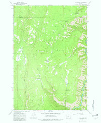
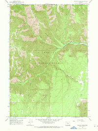
1967 Map of Fry Meadow
USGS Topo · Published 1982About this map
Umatilla National Forest and Wallowa National Forest meet in this 1967 survey of northeastern Oregon, where the rugged terrain is defined by high meadows and steep drainage systems. Evidence of early mountain habitation and forest management is found at sites like the Kettleson Pearson Cabin and the Fry Meadow Guard Sta. The landscape is etched with a network of a Pack Trail and a Jeep Trail, providing access to remote points like the Lookout Tower atop Lookout Mountain. In the southeast corner, the Grande Ronde River carves through the canyon floor, a sharp contrast to the high-elevation clearings of Jarboe Meadow and Brock Meadows. The presence of the Jaussaud Corral in the northwest suggests the area's continued use for livestock within the forest boundaries.
Find a feature on this map
28 named features on this map. Tap any name to fly to it.
Don’t see what you’re looking for? This feature index may not catch every label — zoom into the map to look around manually.
Map Details
Editions of this 1967 Fry Meadow Map
3 editions found
Other maps of this area

1955 · Grangeville
USGS Topo · 1:250,000

1959 · Grangeville
USGS Topo · 1:250,000

1964 · Partridge Creek
USGS Topo · 1:24,000

1964 · Howard Butte
USGS Topo · 1:24,000

1964 · Rondowa
USGS Topo · 1:24,000

1967 · Fry Meadow
USGS Topo · 1:24,000

1967 · Elbow Creek
USGS Topo · 1:24,000
1967 · Bone Spring
USGS Topo · 1:24,000
1967 · Deep Creek
USGS Topo · 1:24,000
1967 · Wenaha Forks
USGS Topo · 1:24,000