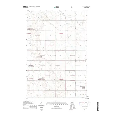
2020 Map of Fryburg
USGS Topo · Published 2020About this map
Fryburg sits at the northern edge of this landscape, serving as a primary point of settlement in this part of Billings County. The map details a transition from the structured street grid of the town, including Logan Ave and Bryan Ave, into the expansive public lands of the Little Missouri National Grassland. This protected territory dominates the western and southern portions of the quadrangle, where the terrain is shaped by the drainage systems of Sully Creek and Norwegian Creek. A notable geographic landmark, Easy Hill, rises above the surrounding area near the intersection of several township boundaries. The map clearly delineates the Public Land Survey System sections, providing a valuable resource for researchers tracing property lines or historical land use within the grassland and the surrounding ranching country.
Find a feature on this map
19 named features on this map. Tap any name to fly to it.
Don’t see what you’re looking for? This feature index may not catch every label — zoom into the map to look around manually.
Map Details
Editions of this 2020 Fryburg Map
This is the sole edition of this map. No revisions or reprints were ever made.
Other maps of this area

1953 · Dickinson
USGS Topo · 1:250,000

1957 · Dickinson
USGS Topo · 1:250,000

1961 · Daglum
USGS Topo · 1:62,500

1961 · Rocky Ridge
USGS Topo · 1:62,500

1962 · Tracy Mountain
USGS Topo · 1:24,000

1962 · Fryburg NE
USGS Topo · 1:24,000

1962 · Belfield SW
USGS Topo · 1:24,000

1962 · Fryburg
USGS Topo · 1:24,000

1962 · Fryburg NW
USGS Topo · 1:24,000

1962 · Belfield
USGS Topo · 1:24,000