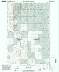
1997 Map of Fryburg
USGS Topo · Published 2001About this map
Fryburg Oil Field and a network of ranching homesteads define this area of western North Dakota during the late 20th century. This portion of the Little Missouri National Grassland is marked by a complex of scoria pits and industrial activity, contrasting with the scattered residential sites like the Bock Ranch, Adams Ranch, and Kordonowy Ranch. The landscape is carved by the drainages of Norwegian Creek and Davis Creek, providing a look at the geographic layout of Billings County prior to modern expansion.
Find a feature on this map
19 named features on this map. Tap any name to fly to it.
Don’t see what you’re looking for? This feature index may not catch every label — zoom into the map to look around manually.
Map Details
Editions of this 1997 Fryburg Map
This is the sole edition of this map. No revisions or reprints were ever made.
Other maps of this area

1953 · Dickinson
USGS Topo · 1:250,000

1957 · Dickinson
USGS Topo · 1:250,000

1961 · Daglum
USGS Topo · 1:62,500

1961 · Rocky Ridge
USGS Topo · 1:62,500

1962 · Tracy Mountain
USGS Topo · 1:24,000

1962 · Fryburg NE
USGS Topo · 1:24,000

1962 · Belfield SW
USGS Topo · 1:24,000

1962 · Fryburg
USGS Topo · 1:24,000

1962 · Fryburg NW
USGS Topo · 1:24,000

1962 · Belfield
USGS Topo · 1:24,000