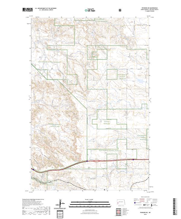
2024 Map of Fryburg NE
USGS Topo · Published 2024About this map
Theodore Roosevelt National Park and the Little Missouri National Grassland dominate this North Dakota landscape, where the badlands topography is deeply carved by drainage systems like Government Creek and Franks Creek. The terrain is characterized by dramatic shifts in elevation, most notably at Cedar Canyon and Painted Canyon in the western reaches. This modern survey illustrates the preservation of these public lands alongside a network of trails such as the Upper Talkington Trl and Upper Paddock Creek Trl.
Find a feature on this map
29 named features on this map. Tap any name to fly to it.
Don’t see what you’re looking for? This feature index may not catch every label — zoom into the map to look around manually.
Map Details
Editions of this 2024 Fryburg NE Map
This is the sole edition of this map. No revisions or reprints were ever made.
Other maps of this area

1953 · Dickinson
USGS Topo · 1:250,000

1953 · Watford City
USGS Topo · 1:250,000

1957 · Dickinson
USGS Topo · 1:250,000

1957 · Watford City
USGS Topo · 1:250,000

1962 · Tracy Mountain
USGS Topo · 1:24,000

1962 · Fryburg NE
USGS Topo · 1:24,000

1962 · Belfield SW
USGS Topo · 1:24,000

1962 · Fryburg
USGS Topo · 1:24,000

1962 · Fryburg NW
USGS Topo · 1:24,000

1962 · Belfield
USGS Topo · 1:24,000