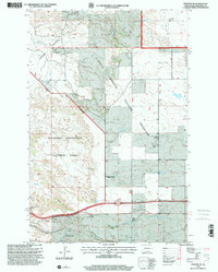
1997 Map of Fryburg NE
USGS Topo · Published 2001About this map
Theodore Roosevelt National Park and the Little Missouri National Grassland dominate this corner of Billings County, showcasing a landscape defined by sharp elevation changes and extraction industries. The western edge of the map features the dramatic topography of Painted Canyon and the Painted Canyon Overlook, while the central and eastern portions are marked by the extensive Fryburg Oil Field.
Find a feature on this map
30 named features on this map. Tap any name to fly to it.
Don’t see what you’re looking for? This feature index may not catch every label — zoom into the map to look around manually.
Map Details
Editions of this 1997 Fryburg NE Map
This is the sole edition of this map. No revisions or reprints were ever made.
Other maps of this area

1953 · Dickinson
USGS Topo · 1:250,000

1953 · Watford City
USGS Topo · 1:250,000

1957 · Dickinson
USGS Topo · 1:250,000

1957 · Watford City
USGS Topo · 1:250,000

1962 · Tracy Mountain
USGS Topo · 1:24,000

1962 · Fryburg NE
USGS Topo · 1:24,000

1962 · Belfield SW
USGS Topo · 1:24,000

1962 · Fryburg
USGS Topo · 1:24,000

1962 · Fryburg NW
USGS Topo · 1:24,000

1962 · Belfield
USGS Topo · 1:24,000