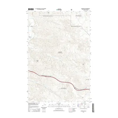
2014 Map of Fryburg NW
USGS Topo · Published 2014About this map
Theodore Roosevelt National Park and the surrounding Little Missouri National Grassland dominate this section of the North Dakota badlands. The terrain is defined by complex drainage networks, where Paddock Cr and Jones Cr carve through the plateau toward the Little Missouri River. The map highlights the intersection of protected wilderness and energy extraction, featuring the Theodore Roosevelt Oil Field in the north and the Scoria Oil Field further south. Distinctive landforms such as Scoria Point, Buck Hill, and Painted Canyon provide clear landmarks within the undulating topography. Historical land use is suggested by names like Beef Corral Bottom and Peaceful Valley, while vital water sources such as Boicourt Spring and Sheep Butte Spring are documented across the arid landscape.
Find a feature on this map
21 named features on this map. Tap any name to fly to it.
Don’t see what you’re looking for? This feature index may not catch every label — zoom into the map to look around manually.
Map Details
Editions of this 2014 Fryburg NW Map
This is the sole edition of this map. No revisions or reprints were ever made.
Other maps of this area

1953 · Dickinson
USGS Topo · 1:250,000

1953 · Watford City
USGS Topo · 1:250,000

1957 · Dickinson
USGS Topo · 1:250,000

1957 · Watford City
USGS Topo · 1:250,000

1962 · Tracy Mountain
USGS Topo · 1:24,000

1962 · Fryburg NE
USGS Topo · 1:24,000

1962 · Fryburg
USGS Topo · 1:24,000

1962 · Fryburg NW
USGS Topo · 1:24,000

1963 · Gorham SW
USGS Topo · 1:24,000

1963 · Gorham SE
USGS Topo · 1:24,000