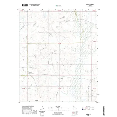
2020 Map of Fryeburg
USGS Topo · Published 2020About this map
Fryeburg and Lawhon anchor this section of Northern Louisiana along the border of Webster and Bienville Parishes. The landscape is defined by the drainage network of Black Lake Bayou, which feeds into Clear Lake and is supported by numerous tributaries including Bashaway Cr and Leatherman Cr. The presence of Madden Mill Cr and Madden Mill Creek Rd suggests a history of local industry tied to the water. Genealogists will find several family-named landmarks and burial sites, such as Gamel Cem, Madden Cem, and Moore Cem, scattered among a dense network of local routes like Boga Lewis Rd and Mims Grocery Rd. The rural character is further emphasized by the Pleasant Hill Church and various parish roads that crisscross the timbered and wetland terrain.
Find a feature on this map
57 named features on this map. Tap any name to fly to it.
Don’t see what you’re looking for? This feature index may not catch every label — zoom into the map to look around manually.
Map Details
Editions of this 2020 Fryeburg Map
This is the sole edition of this map. No revisions or reprints were ever made.
Other maps of this area

1947 · Ringgold
USGS Topo · 1:62,500

1947 · Minden
USGS Topo · 1:62,500

1948 · Jamestown
USGS Topo · 1:62,500

1949 · Jamestown
USGS Topo · 1:62,500

1949 · Minden
USGS Topo · 1:62,500

1949 · Gibsland
USGS Topo · 1:62,500

1950 · Gibsland
USGS Topo · 1:62,500

1955 · Shreveport
USGS Topo · 1:250,000

1956 · Shreveport
USGS Topo · 1:250,000

1956 · Ringgold
USGS Topo · 1:62,500