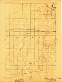
1894 Map of Fullerton
USGS Topo · Published 1904About this map
Fullerton and the winding course of the Maple River anchor this late-nineteenth-century look at Dickey County. Surveyed by Van H. Manning and G.T. Hawkins in 1892, the landscape is defined by the early expansion of the northern plains rail network. The northern corridor is served by the Minneapolis St. Paul and Sault Ste. Marie R.R., which passes through the small settlement of Yorktown, while the southern reaches near Silver Leaf are traversed by the St. Paul Minneapolis and Manitoba R.R.
Find a feature on this map
14 named features on this map. Tap any name to fly to it.
Don’t see what you’re looking for? This feature index may not catch every label — zoom into the map to look around manually.
Map Details
Editions of this 1894 Fullerton Map
2 editions found
Other maps of this area

1894 · Monango
USGS Topo · 1:62,500

1894 · La Moure
USGS Topo · 1:62,500

1894 · Ellendale
USGS Topo · 1:62,500

1894 · Hecla
USGS Topo · 1:62,500

1894 · Savo
USGS Topo · 1:62,500

1894 · Fullerton
USGS Topo · 1:62,500

1894 · Oakes
USGS Topo · 1:62,500

1895 · Lamoure
USGS Topo · 1:125,000

1896 · Columbia
USGS Topo · 1:125,000

1896 · Edgeley
USGS Topo · 1:125,000