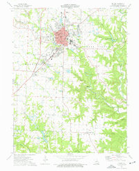
1975 Map of Fulton
USGS Topo · Published 1977About this map
Educational institutions and civic landmarks define the mid-1970s character of Fulton. The city is depicted as a significant regional hub, anchored by Westminster College, William Woods College, and the Missouri School for the Deaf. Near the city center, the Churchill Memorial stands as a notable historical marker. The landscape surrounding the town is deeply etched by the extractive industry, with numerous Claypits and a large Strip Mine north of Stinson Creek. To the south and east, the terrain transitions into a network of drainages including Dark Hollow, Big Hollow, and Crows Fork Creek. Smaller rural points of interest such as the United Brethren Cem, Mt Carmel Ch, and St Peters Sch are scattered across the townships of St Aubert, Caldwell, and East Fulton, providing valuable location data for genealogists.
Find a feature on this map
61 named features on this map. Tap any name to fly to it.
Don’t see what you’re looking for? This feature index may not catch every label — zoom into the map to look around manually.
Map Details
Editions of this 1975 Fulton Map
2 editions found
Other maps of this area

1886 · Jefferson City
USGS Topo · 1:125,000

1890 · Fulton
USGS Topo · 1:125,000

1894 · Jefferson City
USGS Topo · 1:125,000

1928 · Fulton
USGS Topo · 1:62,500

1931 · Fulton
USGS Topo · 1:62,500

1939 · Jefferson City
USGS Topo · 1:62,500

1942 · Jefferson City
USGS Topo · 1:62,500

1944 · Millersburg
USGS Topo · 1:62,500

1945 · Mokane
USGS Topo · 1:62,500

1946 · Millersburg
USGS Topo · 1:62,500