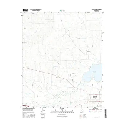
2016 Map of Gafford Chapel
USGS Topo · Published 2016About this map
Gafford Chapel remains a quiet central point in Hopkins County, situated just northwest of the growing urban reach of Sulphur Springs. This landscape is defined by its sophisticated water management and drainage network, where multiple tributaries like Crooks Creek and Blacks Creek feed into the broad basin of White Oak Creek. The area is notably punctuated by several significant reservoirs, including the expansive Lake Sulphur Springs and smaller bodies like Century Lake, White Oak Lake, and James R Beck Lake, reflecting the region's historical reliance on managed water resources for municipal and agricultural needs.
Find a feature on this map
57 named features on this map. Tap any name to fly to it.
Don’t see what you’re looking for? This feature index may not catch every label — zoom into the map to look around manually.
Map Details
Editions of this 2016 Gafford Chapel Map
This is the sole edition of this map. No revisions or reprints were ever made.
Other maps of this area

1953 · Texarkana
USGS Topo · 1:250,000

1956 · Texarkana
USGS Topo · 1:250,000

1962 · Miller Grove
USGS Topo · 1:24,000

1962 · Brashear
USGS Topo · 1:24,000

1964 · Cumby
USGS Topo · 1:24,000

1964 · Sulphur Springs
USGS Topo · 1:24,000

1964 · Gafford Chapel
USGS Topo · 1:24,000

1964 · Klondike
USGS Topo · 1:24,000

1964 · Tira
USGS Topo · 1:24,000
1964 · Cooper South
USGS Topo · 1:24,000