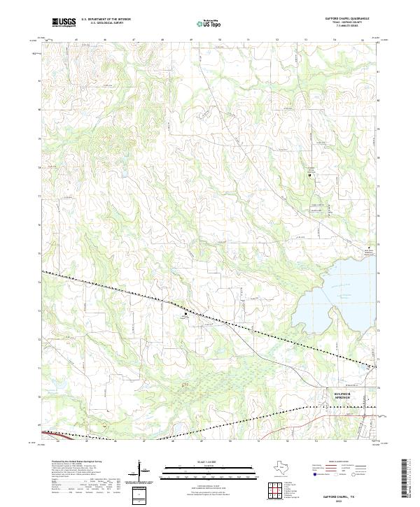
2022 Map of Gafford Chapel
USGS Topo · Published 2022About this map
Sulphur Springs anchors the southeastern corner of this Hopkins County landscape, where the town's grid meets the expansive Lake Sulphur Springs. The geography is defined by a dense network of tributaries including White Oak Creek and Horse Pen Cr, which drain the undulating terrain north of the city. This area is characterized by rural transit corridors like FM 2285 and FM 2653 that connect scattered agricultural plots and family landmarks.
Find a feature on this map
63 named features on this map. Tap any name to fly to it.
Don’t see what you’re looking for? This feature index may not catch every label — zoom into the map to look around manually.
Map Details
Editions of this 2022 Gafford Chapel Map
This is the sole edition of this map. No revisions or reprints were ever made.
Other maps of this area

1953 · Texarkana
USGS Topo · 1:250,000

1956 · Texarkana
USGS Topo · 1:250,000

1962 · Miller Grove
USGS Topo · 1:24,000

1962 · Brashear
USGS Topo · 1:24,000

1964 · Cumby
USGS Topo · 1:24,000

1964 · Sulphur Springs
USGS Topo · 1:24,000

1964 · Gafford Chapel
USGS Topo · 1:24,000

1964 · Klondike
USGS Topo · 1:24,000

1964 · Tira
USGS Topo · 1:24,000
1964 · Cooper South
USGS Topo · 1:24,000