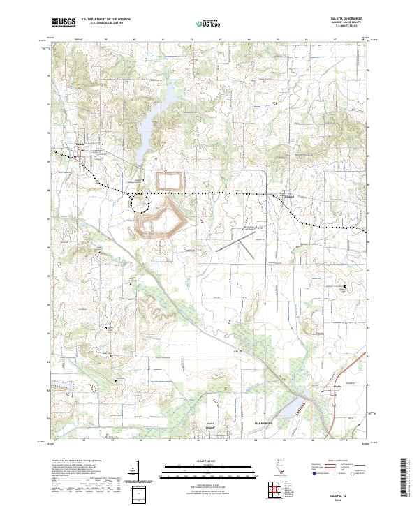
2024 Map of Galatia
USGS Topo · Published 2024About this map
The Middle Fork Saline River snakes across this Saline County landscape, defining the low-lying drainage patterns between the historic village centers of Galatia and Raleigh. This modern topographical study captures a region where agriculture and aviation meet, anchored by the Harrisburg-Raleigh Airport. The area is notably dense with family heritage sites, preserving several small burial grounds such as the Simpson Family Cem, Stricklin Family Cem, and Webber Campground Cem. These sites, often located along rural routes like Barton Cemetery Rd or near the banks of Wolf Creek and Brushy Creek, offer a clear spatial record for genealogists. To the south, the terrain descends toward Dorris Heights and the Bankston Fork, where the urban fringes of Harrisburg begin to appear alongside the settlement of Muddy.
Find a feature on this map
92 named features on this map. Tap any name to fly to it.
Don’t see what you’re looking for? This feature index may not catch every label — zoom into the map to look around manually.
Map Details
Editions of this 2024 Galatia Map
This is the sole edition of this map. No revisions or reprints were ever made.
Other maps of this area

1905 · Eldorado
USGS Topo · 1:62,500

1906 · Eldorado
USGS Topo · 1:62,500

1908 · Galatia
USGS Topo · 1:62,500

1916 · Equality
USGS Topo · 1:62,500

1925 · Harrisburg
USGS Topo · 1:62,500

1938 · Galatia
USGS Topo · 1:62,500

1939 · Harrisburg
USGS Topo · 1:62,500

1949 · Paducah
USGS Topo · 1:250,000

1950 · Paducah
USGS Topo · 1:250,000

1954 · Paducah
USGS Topo · 1:250,000