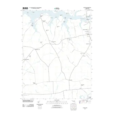
2011 Map of Galena
USGS Topo · Published 2011About this map
The Sassafras River forms a wide, irregular northern boundary for this Maryland landscape, where the colonial-era twin towns of Fredericktown and Georgetown face each other across the narrowest point of the water. This agricultural interior is punctuated by historic crossroads and small settlements like Galena, Chesterville, and Kennedyville. The map captures a detailed network of rural infrastructure, from the Galena Post Office to the Krastel Farms Airport, alongside several significant burial grounds including Shrewsbury Cemetery and Saint Dennis Cemetery.
Find a feature on this map
81 named features on this map. Tap any name to fly to it.
Don’t see what you’re looking for? This feature index may not catch every label — zoom into the map to look around manually.
Map Details
Editions of this 2011 Galena Map
This is the sole edition of this map. No revisions or reprints were ever made.
Other maps of this area

1898 · Tolchester
USGS Topo · 1:125,000

1899 · Dover
USGS Topo · 1:125,000

1900 · Cecilton
USGS Topo · 1:62,500

1900 · Betterton
USGS Topo · 1:62,500

1901 · Chestertown
USGS Topo · 1:62,500

1903 · Tolchester
USGS Topo · 1:125,000

1905 · Barclay
USGS Topo · 1:62,500

1906 · Dover
USGS Topo · 1:125,000

1908 · Tolchester
USGS Topo · 1:125,000

1920 · Dover
USGS Topo · 1:125,000