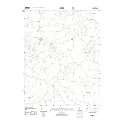
2011 Map of Gallia
USGS Topo · Published 2011About this map
Cambria Furnace and the Blackfork Post Office stand as reminders of the industrial history that shaped this section of Ohio. The landscape is defined by its many winding valleys and ridges, including Irish Hollow, Kokeene Hollow, and Dry Ridge. Small settlements like Blackfork Junction, Kitchen, and Peniel are connected by a network of rural roads such as Gallia-Blackfork Rd and Shaffer School Rd.
Find a feature on this map
84 named features on this map. Tap any name to fly to it.
Don’t see what you’re looking for? This feature index may not catch every label — zoom into the map to look around manually.
Map Details
Editions of this 2011 Gallia Map
This is the sole edition of this map. No revisions or reprints were ever made.
Other maps of this area

1898 · Ironton
USGS Topo · 1:62,500

1900 · Ironton
USGS Topo · 1:62,500

1906 · Bidwell
USGS Topo · 1:62,500

1906 · Athalia
USGS Topo · 1:62,500

1908 · Bidwell
USGS Topo · 1:62,500

1908 · Athalia
USGS Topo · 1:62,500

1912 · Oak Hill
USGS Topo · 1:62,500

1957 · Huntington
USGS Topo · 1:250,000

1960 · Huntington
USGS Topo · 1:250,000
1961 · Petersburg
USGS Topo · 1:24,000