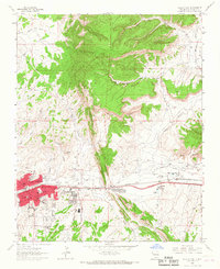
1963 Map of Gallup East
USGS Topo · Published 1967About this map
The Hogback dominates the central topography of this mid-1960s survey, a sharp geological spine that divides the developing city of Gallup from the industrial and mission lands to the east. The map captures the city's eastward expansion, showing residential grids around Aztec Ave and Wilson Ave transitioning into a landscape heavily shaped by extraction. The northern and eastern sectors are dotted with significant mining operations, including the Heaton Mine, Weaver Mine, and Gibson Mine, illustrating the region's historical dependence on coal and minerals. Along the corridor of the Atchison Topeka and Santa Fe railroad, the community of Rehoboth appears with its mission-associated features like the Rehoboth Cem and a dedicated hospital. This document provides a detailed look at the intersection of Navajo Nation borders, industrial mining, and the growth of a vital New Mexico transportation hub.
Find a feature on this map
57 named features on this map. Tap any name to fly to it.
Don’t see what you’re looking for? This feature index may not catch every label — zoom into the map to look around manually.
Map Details
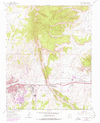
Editions of this 1963 Gallup East Map
2 editions found
Other maps of this area

1886 · Wingate
USGS Topo · 1:250,000

1892 · Wingate
USGS Topo · 1:250,000

1954 · Gallup
USGS Topo · 1:250,000

1958 · Gallup
USGS Topo · 1:250,000

1959 · Gallup
USGS Topo · 1:250,000

1962 · Gallup
USGS Topo · 1:250,000

1963 · Twin Lakes
USGS Topo · 1:24,000

1963 · Big Rock Hill
USGS Topo · 1:24,000

1963 · Twin Buttes
USGS Topo · 1:24,000

1963 · Gallup West
USGS Topo · 1:24,000