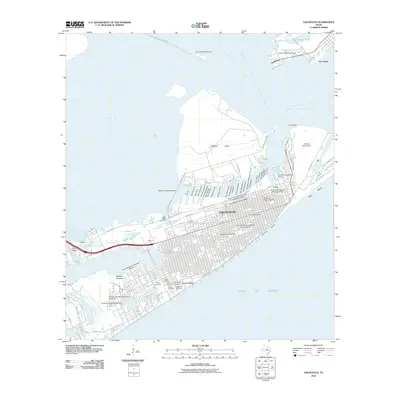
2010 Map of Galveston
USGS Topo · Published 2010About this map
Galveston dominates this coastal landscape, showcasing a dense urban and maritime environment protected by the Galveston Seawall. The map reveals the intricate network of the city's waterfront, from the modern Texas Cruise Ship Terminal on Galveston Island to the historic Mosquito Fleet Berth at Pier 19. Deep historical roots are evident in the numerous preservation areas, including The Strand Historic District and the Silk Stocking Residential Historic District, while maritime heritage is anchored by Point Bolivar Lighthouse across the channel.
Find a feature on this map
68 named features on this map. Tap any name to fly to it.
Don’t see what you’re looking for? This feature index may not catch every label — zoom into the map to look around manually.
Map Details
Editions of this 2010 Galveston Map
This is the sole edition of this map. No revisions or reprints were ever made.
Other maps of this area

1929 · Virginia Point
USGS Topo · 1:24,000

1929 · Texas City
USGS Topo · 1:24,000

1930 · Galveston
USGS Topo · 1:24,000

1931 · Lake Como
USGS Topo · 1:24,000

1931 · Flake
USGS Topo · 1:24,000

1932 · Texas City
USGS Topo · 1:31,680

1932 · Bolivar Point
USGS Topo · 1:24,000

1932 · Virginia Point
USGS Topo · 1:31,680

1933 · The Jetties
USGS Topo · 1:31,680

1933 · Bolivar Point
USGS Topo · 1:31,680