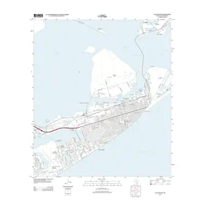
2013 Map of Galveston
USGS Topo · Published 2013About this map
The dense urban grid of Galveston and the narrow reach of the Bolivar Peninsula anchor this 2013 survey of the Texas coast. The map illustrates a landscape shaped by maritime industry and deep history, from the historic Fort Travis at the tip of the peninsula to the defensive works of Fort Crockett overlooking the Gulf of Mexico. Along the waterfront, a sequence of numbering defines the commercial district, including Pier 10 and Pier 14, while the Cruise Ship Terminal on Galveston Island marks the modern economic engine of the port.
Find a feature on this map
96 named features on this map. Tap any name to fly to it.
Don’t see what you’re looking for? This feature index may not catch every label — zoom into the map to look around manually.
Map Details
Editions of this 2013 Galveston Map
This is the sole edition of this map. No revisions or reprints were ever made.
Other maps of this area

1929 · Virginia Point
USGS Topo · 1:24,000

1929 · Texas City
USGS Topo · 1:24,000

1930 · Galveston
USGS Topo · 1:24,000

1931 · Lake Como
USGS Topo · 1:24,000

1931 · Flake
USGS Topo · 1:24,000

1932 · Texas City
USGS Topo · 1:31,680

1932 · Bolivar Point
USGS Topo · 1:24,000

1932 · Virginia Point
USGS Topo · 1:31,680

1933 · The Jetties
USGS Topo · 1:31,680

1933 · Bolivar Point
USGS Topo · 1:31,680