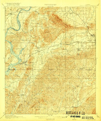
1917 Map of Gantts Quarry
USGS Topo · Published 1917About this map
Industrial activity and rural river life intersect along the Coosa River in this survey of Alabama's marble-producing region. The landscape is dominated by the ridges of Kahatchee Mountain and Cohabie Mtn, which frame a network of extractive sites including Gantts Quarry and Eureka Quarry. These industrial hubs are supported by a dense rail network consisting of the Southern, Central of Georgia, and Louisville and Nashville railroads, which facilitated the transport of stone and timber from the interior.
Find a feature on this map
60 named features on this map. Tap any name to fly to it.
Don’t see what you’re looking for? This feature index may not catch every label — zoom into the map to look around manually.
Map Details
Editions of this 1917 Gantts Quarry Map
3 editions found

Other maps of this area

1890 · Bessemer
USGS Topo · 1:125,000

1890 · Talladega
USGS Topo · 1:125,000

1891 · Clanton
USGS Topo · 1:125,000

1892 · Talladega
USGS Topo · 1:125,000

1892 · Bessemer
USGS Topo · 1:125,000

1901 · Wetumpka
USGS Topo · 1:125,000

1903 · Wetumpka
USGS Topo · 1:125,000

1906 · Vandiver
USGS Topo · 1:62,500

1908 · Vandiver
USGS Topo · 1:62,500

1909 · Columbiana
USGS Topo · 1:62,500