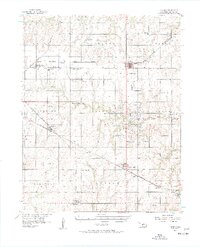
1956 Map of Garber
USGS Topo · Published 1957About this map
The town of Garber serves as a central hub in this mid-century survey of the Oklahoma wheat belt, where the local economy and geography are defined by a dense grid of railroads and section-line roads. The Chicago Rock Island And Pacific and ST Louis San Francisco railroads cut diagonally across the landscape, connecting elevators and small agrarian settlements like Breckenridge, Covington, and Fairmont.
Find a feature on this map
43 named features on this map. Tap any name to fly to it.
Don’t see what you’re looking for? This feature index may not catch every label — zoom into the map to look around manually.
Map Details
Editions of this 1956 Garber Map
2 editions found
Other maps of this area

1893 · Mulhall
USGS Topo · 1:62,500

1893 · Lovell
USGS Topo · 1:62,500

1893 · Hennessey
USGS Topo · 1:62,500

1955 · Enid East
USGS Topo · 1:24,000

1955 · Enid
USGS Topo · 1:250,000

1956 · Garber
USGS Topo · 1:62,500

1956 · Hennessey
USGS Topo · 1:62,500

1956 · Enid
USGS Topo · 1:62,500

1958 · Enid
USGS Topo · 1:250,000

1968 · Lamont SE
USGS Topo · 1:24,000