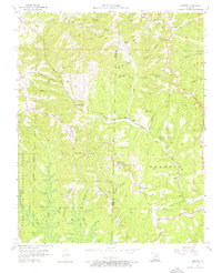
1956 Map of Garber
USGS Topo · Published 1976About this map
Indian Ridge and Compton Ridge dominate this mid-century landscape in the White River hills, showing a region transitioning from isolated hollows to a nascent tourism destination. Cultural landmarks like Inspiration Point and Old Matts Cabin at the Shepherd of the Hills Museum reflect the literary and historical identity of the Ozarks, while the Garber Sch and small communities like Gretna and Garber represent the older rural settlement patterns.
Find a feature on this map
41 named features on this map. Tap any name to fly to it.
Don’t see what you’re looking for? This feature index may not catch every label — zoom into the map to look around manually.
Map Details
Editions of this 1956 Garber Map
3 editions found
Other maps of this area

1907 · Forsyth
USGS Topo · 1:125,000

1945 · Harrison
USGS Topo · 1:250,000

1949 · Harrison
USGS Topo · 1:250,000

1950 · Garber
USGS Topo · 1:24,000

1954 · Harrison
USGS Topo · 1:250,000

1955 · Day
USGS Topo · 1:24,000

1956 · Lampe
USGS Topo · 1:24,000

1956 · Table Rock Dam
USGS Topo · 1:24,000

1956 · Garber
USGS Topo · 1:24,000
1956 · Spokane
USGS Topo · 1:24,000