
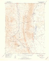
1951 Map of Garden Valley
USGS Topo · Published 1951About this map
Sulphur Range and the high basins of Central Nevada are captured here during a period of transition for the local ranching and mining economy. The map illustrates a landscape defined by isolated outposts such as Sadler Ranch and Romano Ranch, which relied on scattered water sources like Shipley Hot Spring and Tule Dam Spring to survive in the arid terrain. While the Diamond Valley School served the families of these remote holdings, the industrial character of the region is grounded in the presence of the Prince of Wales Mine and the Mt Hope Mine (Abandoned). The latter is notably marked with a Tailings Pond and Pipeline, detailing the physical infrastructure required for extraction in the high desert. Connecting these points are primitive routes over Bailey Pass and through Mulligan Gap, tracing the rugged geography between Garden Valley and Diamond Valley.
Find a feature on this map
38 named features on this map. Tap any name to fly to it.
Don’t see what you’re looking for? This feature index may not catch every label — zoom into the map to look around manually.
Map Details
Editions of this 1951 Garden Valley Map
2 editions found
Other maps of this area

1926 · Roberts Mountains
USGS Topo · 1:250,000

1929 · Roberts Mountains
USGS Topo · 1:250,000

1934 · Jiggs
USGS Topo · 1:125,000

1937 · Mineral Hill
USGS Topo · 1:48,000

1937 · Jiggs
USGS Topo · 1:125,000

1943 · Mineral Hill
USGS Topo · 1:62,500

1949 · Garden Valley
USGS Topo · 1:62,500

1949 · Roberts Creek Mtn
USGS Topo · 1:62,500

1951 · Roberts Creek Mtn
USGS Topo · 1:62,500

1953 · Eureka
USGS Topo · 1:62,500