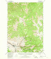
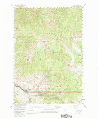
1955 Map of Gardiner
USGS Topo · Published 1974About this map
Gardiner serves as the focal point for this mid-century survey of the Montana-Wyoming border, situated at the North Entrance Yellowstone National Park. The landscape is dominated by the confluence of the Yellowstone River and Gardiner, where the topography transitions from the mountain peaks of the Gallatin National Forest into the dramatic Black Canyon of the Yellowstone River. Near the settlement of Jardine, the map documents industrial and recreational footprints including quarries on Mineral Hill and the Jardine-Hellroaring Trail. Further east, peaks like Buffalo Mtn and Crevice Mtn rise above the river valley. The presence of Blanding Sta and a local Cem near the park boundary provides valuable data for genealogists tracing early residents of Park County and those associated with the gateway to the nation's first national park.
Find a feature on this map
63 named features on this map. Tap any name to fly to it.
Don’t see what you’re looking for? This feature index may not catch every label — zoom into the map to look around manually.
Map Details
Editions of this 1955 Gardiner Map
5 editions found
Other maps of this area

1885 · Gallatin
USGS Topo · 1:125,000

1885 · Gallatin
USGS Topo · 1:125,000

1886 · Canyon
USGS Topo · 1:125,000

1891 · Livingston
USGS Topo · 1:250,000

1893 · Livingston
USGS Topo · 1:250,000

1895 · Canyon
USGS Topo · 1:125,000

1896 · Canyon
USGS Topo · 1:125,000

1901 · Canyon
USGS Topo · 1:125,000

1901 · Gallatin
USGS Topo · 1:125,000

1907 · Canyon
USGS Topo · 1:125,000