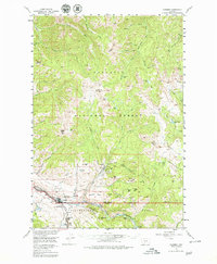
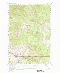
1955 Map of Gardiner
USGS Topo · Published 1979About this map
Gardiner serves as the focal point of this mid-century survey, situated at the historic North Entrance Yellowstone National Park along the Yellowstone River. The area's industrial and transportation history is evident through the Northern Pacific rail line and local infrastructure like Blanding Sta and the Cem nearby. To the northeast, the settlement of Jardine sits high above the river valley, flanked by Mineral Hill and Hanlon Hill, highlighting the region's mining legacy near the Quarries.
Find a feature on this map
73 named features on this map. Tap any name to fly to it.
Don’t see what you’re looking for? This feature index may not catch every label — zoom into the map to look around manually.
Map Details
Editions of this 1955 Gardiner Map
5 editions found
Other maps of this area

1885 · Gallatin
USGS Topo · 1:125,000

1885 · Gallatin
USGS Topo · 1:125,000

1886 · Canyon
USGS Topo · 1:125,000

1891 · Livingston
USGS Topo · 1:250,000

1893 · Livingston
USGS Topo · 1:250,000

1895 · Canyon
USGS Topo · 1:125,000

1896 · Canyon
USGS Topo · 1:125,000

1901 · Canyon
USGS Topo · 1:125,000

1901 · Gallatin
USGS Topo · 1:125,000

1907 · Canyon
USGS Topo · 1:125,000