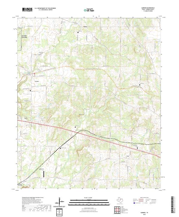
2022 Map of Garner
USGS Topo · Published 2022About this map
Garner and Authon anchor this portion of Parker County, characterized by a complex network of intermittent creeks and family-named cemeteries. The landscape is defined by the drainage of Grindstone Cr and its tributaries, including Beal Br and Cottonwood Br, which carve through the terrain south of Buzzard Hill. This contemporary look at the region shows the persistence of rural settlements alongside modern landmarks like Reb Folbre's Place Airport and Windy Tales Airport. Local history is deeply etched into the land through numerous burial grounds such as Newberry Cem and Porter Cem. The Lake Mineral Wells State Trailway Trl provides a cross-county corridor for recreation, following a legacy route through the hills. Small communities like Cool, Fox, and Millsap are connected by a web of rural roads, including the descriptive Franko Switch Rd and Old Garner Rd.
Find a feature on this map
90 named features on this map. Tap any name to fly to it.
Don’t see what you’re looking for? This feature index may not catch every label — zoom into the map to look around manually.
Map Details
Editions of this 2022 Garner Map
This is the sole edition of this map. No revisions or reprints were ever made.
Other maps of this area

1891 · Weatherford
USGS Topo · 1:125,000

1891 · Palo Pinto
USGS Topo · 1:125,000

1893 · Weatherford
USGS Topo · 1:125,000

1918 · Palo Pinto
USGS Topo · 1:125,000

1927 · Mineral Wells
USGS Topo · 1:62,500

1931 · Dennis
USGS Topo · 1:62,500

1931 · Santo
USGS Topo · 1:62,500

1954 · Dallas
USGS Topo · 1:250,000

1954 · Abilene
USGS Topo · 1:250,000

1958 · Dallas
USGS Topo · 1:250,000