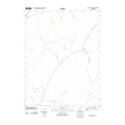
2010 Map of Garvey Canyon
USGS Topo · Published 2010About this map
Bunniger Mine and the Stove Canyon Mine occupy the southwest corner of this drainage-carved terrain, marking the industrial reach of the Colorado plateau. The landscape is defined by an intricate network of deep incisions, ranging from the prominent Garvey Canyon to the suggestively named Hells Hole Canyon. These geological features dictate the limited human presence in the area, which is primarily represented by Cuddy Ranch along the bank of East Gulch. Water is the primary sculptor here, with Big Salt Creek and Big Salt Wash creating significant corridors through the high desert. A rare instance of standing water, Echo Lake, sits tucked into the northeast, providing a sharp contrast to the surrounding canyon systems like Lapham Canyon and Post Canyon.
Find a feature on this map
22 named features on this map. Tap any name to fly to it.
Don’t see what you’re looking for? This feature index may not catch every label — zoom into the map to look around manually.
Map Details
Editions of this 2010 Garvey Canyon Map
This is the sole edition of this map. No revisions or reprints were ever made.
Other maps of this area

1956 · Grand Junction
USGS Topo · 1:250,000

1959 · Grand Junction
USGS Topo · 1:250,000

1960 · Grand Junction
USGS Topo · 1:250,000

1962 · Grand Junction
USGS Topo · 1:250,000

1964 · Grand Junction
USGS Topo · 1:250,000

1964 · Douglas Pass
USGS Topo · 1:24,000

1964 · Henderson Ridge
USGS Topo · 1:24,000

1964 · Calf Canyon
USGS Topo · 1:24,000

1965 · Grand Junction
USGS Topo · 1:250,000
1968 · Howard Canyon
USGS Topo · 1:24,000