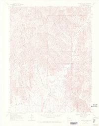
1968 Map of Howard Canyon
USGS Topo · Published 1971About this map
Young Ranch sits amidst a network of deep drainage systems in this late 1960s survey of Garfield County. The landscape is defined by the sharp verticality of Howard Canyon and Demaree Canyon, where the rugged topography necessitated the use of a Jeep Trail for navigation. Evidence of resource exploration is scattered across the terrain, including a Gas Well in the south and multiple Drill Holes located near the headwaters of Salt Creek. The map documents a period of industrial activity in the high country, marked by a Pipeline and a Gravel Pit near East Salt Creek, reflecting the infrastructure required to manage these remote energy and material sites. Seasonal watercourses like Munger Creek and Camp Gulch further illustrate the complex erosional patterns typical of this Colorado plateau region.
Find a feature on this map
15 named features on this map. Tap any name to fly to it.
Don’t see what you’re looking for? This feature index may not catch every label — zoom into the map to look around manually.
Map Details
Editions of this 1968 Howard Canyon Map
3 editions found
Other maps of this area

1956 · Grand Junction
USGS Topo · 1:250,000

1959 · Grand Junction
USGS Topo · 1:250,000

1960 · Grand Junction
USGS Topo · 1:250,000

1962 · Grand Junction
USGS Topo · 1:250,000

1964 · Grand Junction
USGS Topo · 1:250,000

1964 · Douglas Pass
USGS Topo · 1:24,000

1964 · Baxter Pass
USGS Topo · 1:24,000

1964 · Calf Canyon
USGS Topo · 1:24,000

1965 · Grand Junction
USGS Topo · 1:250,000

1968 · Badger Wash
USGS Topo · 1:24,000