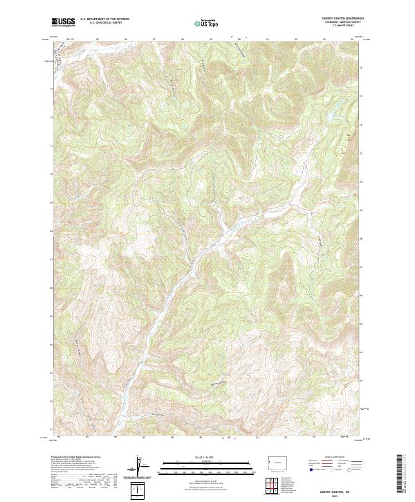
2022 Map of Garvey Canyon
USGS Topo · Published 2022About this map
Garvey Canyon and its surrounding drainages dominate this portion of the Garfield County landscape, where the high desert meets complex canyon systems. The geography is defined by a dense network of watercourses, most notably Big Salt Wash, which snakes through the central terrain alongside smaller tributaries like Munger Cr and Deer Creek. This area serves as a primary corridor for north-south travel, anchored by Douglas Pass Rd (State Highway 139) as it climbs toward the northern boundary.
Find a feature on this map
27 named features on this map. Tap any name to fly to it.
Don’t see what you’re looking for? This feature index may not catch every label — zoom into the map to look around manually.
Map Details
Editions of this 2022 Garvey Canyon Map
This is the sole edition of this map. No revisions or reprints were ever made.
Other maps of this area

1956 · Grand Junction
USGS Topo · 1:250,000

1959 · Grand Junction
USGS Topo · 1:250,000

1960 · Grand Junction
USGS Topo · 1:250,000

1962 · Grand Junction
USGS Topo · 1:250,000

1964 · Grand Junction
USGS Topo · 1:250,000

1964 · Douglas Pass
USGS Topo · 1:24,000

1964 · Henderson Ridge
USGS Topo · 1:24,000

1964 · Calf Canyon
USGS Topo · 1:24,000

1965 · Grand Junction
USGS Topo · 1:250,000
1968 · Howard Canyon
USGS Topo · 1:24,000