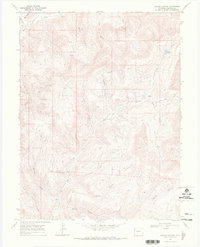
1968 Map of Garvey Canyon
USGS Topo · Published 1972About this map
Cuddy Ranch stands as a focal point of settlement in this 1968 study of the Colorado high country, situated where the drainage of East Deer Creek Gulch meets the complex network of deep ravines that define Garfield County. The landscape is characterized by a series of parallel canyons, including Post Canyon, Lapham Canyon, and Munger Canyon, which channel seasonal water toward the larger Big Salt Wash in the south. The historical Ute Trail winds through the eastern portion of the map, following the ridgelines and offering a glimpse into the traditional movement patterns across this steep terrain. Water remains the critical resource for ranching and survival here, marked by isolated Springs and the presence of Echo Lake in the northeastern corner. From the depths of Hells Hole Canyon to the winding course of Garvey Canyon, the map illustrates a rugged geography where human activity is dictated by the availability of water and the accessibility of the few traversable routes.
Find a feature on this map
23 named features on this map. Tap any name to fly to it.
Don’t see what you’re looking for? This feature index may not catch every label — zoom into the map to look around manually.
Map Details
Editions of this 1968 Garvey Canyon Map
This is the sole edition of this map. No revisions or reprints were ever made.
Other maps of this area

1956 · Grand Junction
USGS Topo · 1:250,000

1959 · Grand Junction
USGS Topo · 1:250,000

1960 · Grand Junction
USGS Topo · 1:250,000

1962 · Grand Junction
USGS Topo · 1:250,000

1964 · Grand Junction
USGS Topo · 1:250,000

1964 · Douglas Pass
USGS Topo · 1:24,000

1964 · Henderson Ridge
USGS Topo · 1:24,000

1964 · Calf Canyon
USGS Topo · 1:24,000

1965 · Grand Junction
USGS Topo · 1:250,000
1968 · Howard Canyon
USGS Topo · 1:24,000