
1967 Map of Gary
USGS Topo · Published 1968About this map
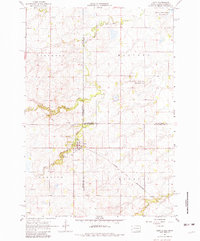
Gary sits at the nexus of the Minnesota and South Dakota border, serving as the primary hub for this agricultural landscape during the late 1960s. The town is situated where the Lac qui Parle River and its West Branch meet, a drainage pattern that historically dictated settlement and transport. The influence of the Chicago and North Western railway is evident, cutting through the southern townships of Florida and Herrick, while an Old Railroad Grade to the west hints at former transit corridors. Conservation is a prominent theme on this sheet, with significant acreage dedicated to the Lac qui Parle State Game Refuge and the Plantation State Wildlife Management Area. Local history is anchored by the Grandview Cem and Calvary Cem, which provide essential reference points for genealogists tracing families in these border townships.
Find a feature on this map
22 named features on this map. Tap any name to fly to it.
Don’t see what you’re looking for? This feature index may not catch every label — zoom into the map to look around manually.
Map Details
Editions of this 1967 Gary Map
2 editions found
Other maps of this area

1953 · Watertown
USGS Topo · 1:250,000

1958 · Watertown
USGS Topo · 1:250,000

1967 · Canby
USGS Topo · 1:24,000

1967 · Canby NW
USGS Topo · 1:24,000

1967 · Gary SE
USGS Topo · 1:24,000

1967 · Gary NW
USGS Topo · 1:24,000
1967 · Mount Wickham
USGS Topo · 1:24,000

1970 · Brandt
USGS Topo · 1:24,000
1973 · Lake Francis
USGS Topo · 1:24,000
1973 · Clear Lake NE
USGS Topo · 1:24,000