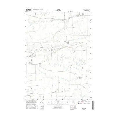
2016 Map of Gasport
USGS Topo · Published 2016About this map
The Erie Canal forms the central artery of this Niagara County landscape, dictating the development of its primary settlements. At Gasport, the waterway is crossed by the Gasport Road Bridge, while further east it passes through Reynales Basin, home to the Slayton Settlement Road Bridge. The surrounding terrain of Chestnut Ridge is defined by a dense network of country roads and small crossroads hamlets like Terrys Corners, McNalls, and Gilberts Corner.
Find a feature on this map
83 named features on this map. Tap any name to fly to it.
Don’t see what you’re looking for? This feature index may not catch every label — zoom into the map to look around manually.
Map Details
Editions of this 2016 Gasport Map
This is the sole edition of this map. No revisions or reprints were ever made.
Other maps of this area

1897 · Olcott
USGS Topo · 1:62,500

1897 · Medina
USGS Topo · 1:62,500

1897 · Lockport
USGS Topo · 1:62,500

1897 · Ridgeway
USGS Topo · 1:62,500

1899 · Niagara
USGS Topo · 1:125,000

1902 · Lockport
USGS Topo · 1:62,500

1905 · Lockport
USGS Topo · 1:62,500

1948 · Lockport
USGS Topo · 1:62,500

1948 · Olcott
USGS Topo · 1:62,500
1949 · Barker
USGS Topo · 1:24,000