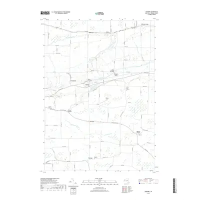
2019 Map of Gasport
USGS Topo · Published 2019About this map
The Erie Canal cuts a historic path across this Niagara County landscape, passing through the hamlets of Orangeport and Gasport. This 2019 survey captures the enduring agricultural and rural character of the region, where numerous family-named burial grounds like the Johnsons Creek Baptist Cem and Mabee Cem dot the landscape alongside small settlements. The drainage patterns of E Br Eighteenmile Cr and Johnson Cr define the local topography, while the Slayton Settlement Road Bridge and Gasport Road Bridge provide essential crossings over the canal. Small crossroad communities such as Reynales Basin, McNalls, and Terrys Corners maintain their identity amidst a network of country roads including Ridge Rd and Chestnut Ridge Rd. The presence of the Royalton Airport south of Gasport indicates the modern utility of this primarily rural corridor.
Find a feature on this map
90 named features on this map. Tap any name to fly to it.
Don’t see what you’re looking for? This feature index may not catch every label — zoom into the map to look around manually.
Map Details
Editions of this 2019 Gasport Map
This is the sole edition of this map. No revisions or reprints were ever made.
Other maps of this area

1897 · Olcott
USGS Topo · 1:62,500

1897 · Medina
USGS Topo · 1:62,500

1897 · Lockport
USGS Topo · 1:62,500

1897 · Ridgeway
USGS Topo · 1:62,500

1899 · Niagara
USGS Topo · 1:125,000

1902 · Lockport
USGS Topo · 1:62,500

1905 · Lockport
USGS Topo · 1:62,500

1948 · Lockport
USGS Topo · 1:62,500

1948 · Olcott
USGS Topo · 1:62,500
1949 · Barker
USGS Topo · 1:24,000