2023 Map of Gasport
USGS Topo · Published 2023About this map
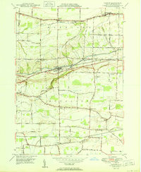
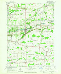
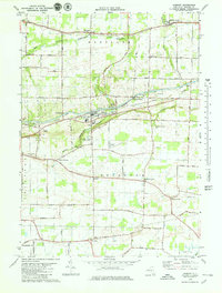
The Erie Canal cuts a distinct horizontal path across this Niagara County landscape, passing through Reynales Basin and Orangeport. This engineering marvel dictates the local geography, with Mirror Lake and the winding East Branch Eighteenmile Creek defining the terrain between the canal and the elevations of Mountain Rd. The map reveals a dense network of early 19th-century rural nodes, including Terrys Corners, McNalls, and Gasport, each tied together by historic thoroughfares like Ridge Rd. Genealogists will find a high density of burial sites documenting the area's early families, from the Hartland Central Cem in the north to the Royalton Union Cem near Dysinger in the south. The distribution of these cemeteries and several small crossroads communities like Gilberts Corner illustrates a settlement pattern rooted in small-scale farming and the logistics of the canal era.
Find a feature on this map
88 named features on this map. Tap any name to fly to it.
Don’t see what you’re looking for? This feature index may not catch every label — zoom into the map to look around manually.
Map Details
Editions of this 2023 Gasport Map
This is the sole edition of this map. No revisions or reprints were ever made.
Historical Maps of McNalls Through Time
4 maps found