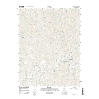
2014 Map of Gassaway
USGS Topo · Published 2014About this map
The Elk River winds in a tight serpentine loop through this part of Braxton County, anchoring the communities of Gassaway and Shadyside. In the early 21st century, the landscape remains defined by its deep drainage network, where numerous runs and forks like Stumble Run and Wolfpen Run have carved out steep hollows between ridges. This complex topography influenced the placement of numerous family and community burial grounds, such as New Fairview Cem and the Houston Carr Cem, often situated on elevated ground or near the junctions of local routes like Little Otter-Belfont Rd.
Find a feature on this map
113 named features on this map. Tap any name to fly to it.
Don’t see what you’re looking for? This feature index may not catch every label — zoom into the map to look around manually.
Map Details
Editions of this 2014 Gassaway Map
This is the sole edition of this map. No revisions or reprints were ever made.
Other maps of this area

1893 · Sutton
USGS Topo · 1:125,000

1906 · Glenville
USGS Topo · 1:62,500

1906 · Burnsville
USGS Topo · 1:62,500

1908 · Gassaway
USGS Topo · 1:48,000

1908 · Sutton
USGS Topo · 1:48,000

1910 · Sutton Special
USGS Topo · 1:62,500

1910 · Gassaway
USGS Topo · 1:62,500

1925 · Glenville
USGS Topo · 1:62,500

1925 · Burnsville
USGS Topo · 1:62,500

1927 · Burnsville
USGS Topo · 1:62,500