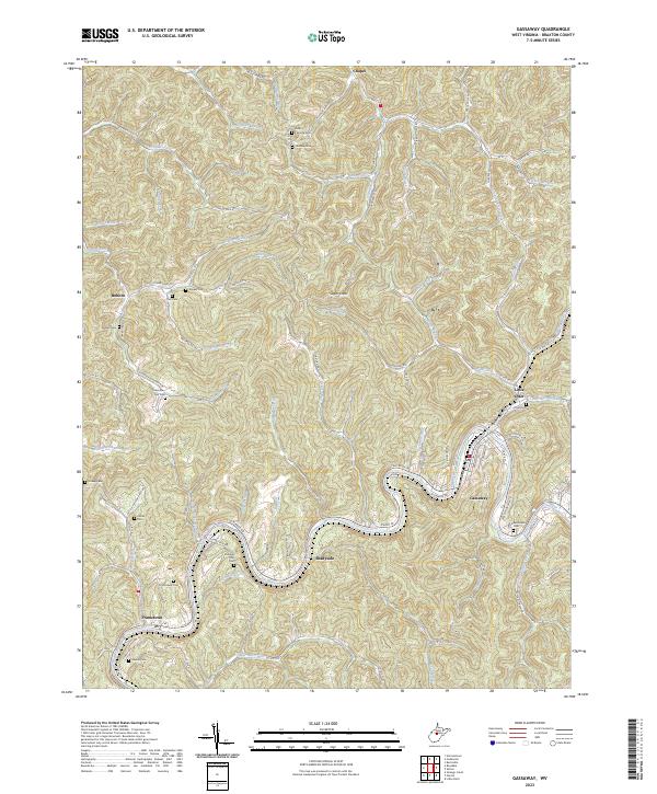
2023 Map of Gassaway
USGS Topo · Published 2023About this map
The Elk River winds through the center of this Braxton County landscape, anchoring a network of narrow valleys and ridges that define the region's settlement patterns. Along the river's southern bend, the communities of Gassaway and Shadyside serve as local hubs, while smaller hamlets like Frametown and Little Otter are tucked into the drainages of numerous tributaries. The terrain is marked by family-named landmarks and upland peaks such as Sugar Knob, reflecting a history of rural kinship and isolated homesteads.
Find a feature on this map
107 named features on this map. Tap any name to fly to it.
Don’t see what you’re looking for? This feature index may not catch every label — zoom into the map to look around manually.
Map Details
Editions of this 2023 Gassaway Map
This is the sole edition of this map. No revisions or reprints were ever made.
Other maps of this area

1893 · Sutton
USGS Topo · 1:125,000

1906 · Glenville
USGS Topo · 1:62,500

1906 · Burnsville
USGS Topo · 1:62,500

1908 · Gassaway
USGS Topo · 1:48,000

1908 · Sutton
USGS Topo · 1:48,000

1910 · Sutton Special
USGS Topo · 1:62,500

1910 · Gassaway
USGS Topo · 1:62,500

1925 · Glenville
USGS Topo · 1:62,500

1925 · Burnsville
USGS Topo · 1:62,500

1927 · Burnsville
USGS Topo · 1:62,500