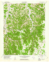
1960 Map of Gassaway
USGS Topo · Published 1961About this map
Pea Ridge forms a prominent geographic spine across this 1960 landscape, where the rugged terrain of the De Kalb and Cannon County line shaped the development of local upland communities. The map documents a period when rural education and worship were centered around sites like Pea Ridge School and the Mount Moriah area. A significant concentration of subterranean features is evident, with named landmarks such as Cave Springs, Indian Grave Point Cave, and Cripps Mill Cave dotting the hollows. The settlement at Gassaway serves as a local hub near Clear Fork, while family legacies are preserved in the numerous cemeteries including Beech Hill Cem and Hale Cem. The network of "hollows," such as Opossum Hollow and Pistole Hollow, illustrates the deep-cut drainage patterns of the Smith Fork watershed.
Find a feature on this map
57 named features on this map. Tap any name to fly to it.
Don’t see what you’re looking for? This feature index may not catch every label — zoom into the map to look around manually.
Map Details
Editions of this 1960 Gassaway Map
3 editions found
Other maps of this area

1893 · Mc Minnville
USGS Topo · 1:125,000

1895 · Mc Minnville
USGS Topo · 1:125,000

1908 · Woodbury
USGS Topo · 1:62,500

1928 · Gordonsville
USGS Topo · 1:62,500

1942 · Statesville
USGS Topo · 1:100,000

1953 · Chattanooga
USGS Topo · 1:250,000

1956 · Columbia
USGS Topo · 1:250,000

1956 · Corbin
USGS Topo · 1:250,000

1956 · Nashville
USGS Topo · 1:250,000

1957 · Chattanooga
USGS Topo · 1:250,000