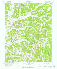
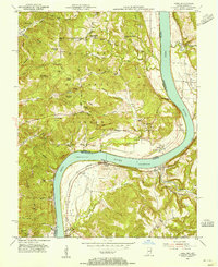
1958 Map of Gatchel
USGS Topo · Published 1959About this map
Hoosier National Forest defines the wooded landscape of Perry County in the late 1950s, where small settlements like Gatchel and Ranger anchor a deeply dissected terrain. The map reveals a community structured around rural institutions, including the Lilly Dale Ch, St Josephs Ch, and St Marks Sch. Numerous family cemeteries such as Lanman Cem, Slaughter Cem, and Rhodes Cem are scattered across the ridges, providing a detailed record for genealogical research.
Find a feature on this map
51 named features on this map. Tap any name to fly to it.
Don’t see what you’re looking for? This feature index may not catch every label — zoom into the map to look around manually.
Map Details
Editions of this 1958 Gatchel Map
4 editions found
Other maps of this area

1900 · St Meinrad
USGS Topo · 1:62,500

1903 · St. Meinrad
USGS Topo · 1:62,500

1903 · Tell City
USGS Topo · 1:62,500

1934 · Cannelton
USGS Topo · 1:62,500

1949 · Cannelton
USGS Topo · 1:24,000

1953 · Cannelton
USGS Topo · 1:24,000

1953 · Tell City
USGS Topo · 1:24,000
1953 · Rome
USGS Topo · 1:24,000

1954 · Evansville
USGS Topo · 1:250,000

1954 · Derby
USGS Topo · 1:24,000