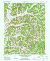
1958 Map of Gatchel
USGS Topo · Published 1981About this map
Leopold and the surrounding township show a landscape transitioning from the wooded tracts of the Hoosier National Forest to active rural settlements in the late 1950s. The map illustrates a community anchored by religious and educational centers, such as St Joseph Ch and St Mark Sch & Ch, alongside several family burial grounds including Slaughter Cem and Hammack Cem. Local geography is defined by a dense network of watercourses like the Middle Fork Anderson River and Sulphur Fork Creek, which carved the ridges that separate small hamlets like Terry and Theis.
Find a feature on this map
44 named features on this map. Tap any name to fly to it.
Don’t see what you’re looking for? This feature index may not catch every label — zoom into the map to look around manually.
Map Details
Editions of this 1958 Gatchel Map
4 editions found
Other maps of this area

1900 · St Meinrad
USGS Topo · 1:62,500

1903 · St. Meinrad
USGS Topo · 1:62,500

1903 · Tell City
USGS Topo · 1:62,500

1934 · Cannelton
USGS Topo · 1:62,500

1949 · Cannelton
USGS Topo · 1:24,000

1953 · Cannelton
USGS Topo · 1:24,000

1953 · Tell City
USGS Topo · 1:24,000
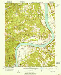
1953 · Rome
USGS Topo · 1:24,000

1954 · Evansville
USGS Topo · 1:250,000

1954 · Derby
USGS Topo · 1:24,000