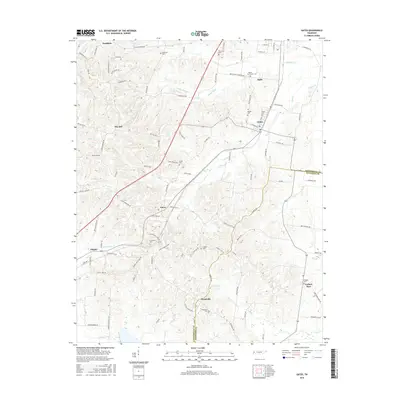
2016 Map of Gates
USGS Topo · Published 2016About this map
Halls and Gates anchor this Lauderdale County landscape, illustrating the established road and drainage networks of West Tennessee. The terrain is defined by a series of creek systems, including Sunrow Cr, Halls Cr, and Lost Cr, which create the undulating topography south of the Forked Deer area. This 2016 data reflects a long history of rural community centers, many of which are identified by family and community burial grounds such as Crossroads Cem, Woodville Cem, and Dunavant Cem. The settlement pattern follows a series of historic corridors like Curve Nankipoo Rd and Beech Bluff Rd, connecting smaller locales like Curve, Flippin, and Dry Hill. Of particular interest to researchers is the concentration of small settlements and named crossroads, including Woodville and Nankipoo, which reveal the enduring spatial organization of the region's agricultural past.
Find a feature on this map
99 named features on this map. Tap any name to fly to it.
Don’t see what you’re looking for? This feature index may not catch every label — zoom into the map to look around manually.
Map Details
Editions of this 2016 Gates Map
This is the sole edition of this map. No revisions or reprints were ever made.
Other maps of this area

1939 · Hales Point
USGS Topo · 1:62,500

1939 · Halls
USGS Topo · 1:62,500

1952 · Hales Point
USGS Topo · 1:62,500

1952 · Gates
USGS Topo · 1:24,000

1952 · Bonicord
USGS Topo · 1:24,000

1952 · Chestnut Bluff
USGS Topo · 1:24,000

1952 · Fowlkes
USGS Topo · 1:24,000

1956 · Blytheville
USGS Topo · 1:250,000

1959 · Blytheville
USGS Topo · 1:250,000

1961 · Hales Point
USGS Topo · 1:62,500