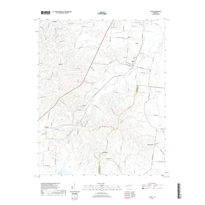
2019 Map of Gates
USGS Topo · Published 2019About this map
Halls and Gates serve as the primary population centers on this landscape, connected by a network of rural roads traversing the rolling terrain of West Tennessee. The geography is defined by a series of north-flowing tributaries, including Sunrow Cr, Halls Cr, and Double Branches, which carve into the plateau. Smaller settlements like Curve, Flippin, and Woodville are scattered across the quadrangle, each marked by historical family footprints and community landmarks. Genealogists will find significant value in the distribution of local burial grounds, such as Crossroads Cem, Thurmand Cem, and Rhodes Cem, which anchor the various townships. The mapping of the Lauderdale Co and Haywood Co line provides a clear view of the political boundary as it interacts with the local drainage systems of Lost Cr and Cane Cr, illustrating the relationship between the natural watercourses and established county borders in the 21st century.
Find a feature on this map
98 named features on this map. Tap any name to fly to it.
Don’t see what you’re looking for? This feature index may not catch every label — zoom into the map to look around manually.
Map Details
Editions of this 2019 Gates Map
This is the sole edition of this map. No revisions or reprints were ever made.
Other maps of this area

1939 · Hales Point
USGS Topo · 1:62,500

1939 · Halls
USGS Topo · 1:62,500

1952 · Hales Point
USGS Topo · 1:62,500

1952 · Gates
USGS Topo · 1:24,000

1952 · Bonicord
USGS Topo · 1:24,000

1952 · Chestnut Bluff
USGS Topo · 1:24,000

1952 · Fowlkes
USGS Topo · 1:24,000

1956 · Blytheville
USGS Topo · 1:250,000

1959 · Blytheville
USGS Topo · 1:250,000

1961 · Hales Point
USGS Topo · 1:62,500