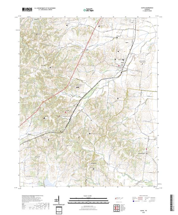
2022 Map of Gates
USGS Topo · Published 2022About this map
The agrarian landscape of West Tennessee is defined here by a dense network of country churches and family burial grounds scattered across the Lauderdale Co Haywood Co border. Small settlements like Gates, Halls, and Nankipoo anchor the northern reaches, while the south is characterized by dispersed hamlets such as Woodville and Forked Deer. This modern survey reveals how local genealogy is preserved in the landscape through numerous sites like the Willette Family Cem, Crockett Cem, and the Antioch Curve Missionary Baptist Church Cem.
Find a feature on this map
116 named features on this map. Tap any name to fly to it.
Don’t see what you’re looking for? This feature index may not catch every label — zoom into the map to look around manually.
Map Details
Editions of this 2022 Gates Map
This is the sole edition of this map. No revisions or reprints were ever made.
Other maps of this area

1939 · Hales Point
USGS Topo · 1:62,500

1939 · Halls
USGS Topo · 1:62,500

1952 · Hales Point
USGS Topo · 1:62,500

1952 · Gates
USGS Topo · 1:24,000

1952 · Bonicord
USGS Topo · 1:24,000

1952 · Chestnut Bluff
USGS Topo · 1:24,000

1952 · Fowlkes
USGS Topo · 1:24,000

1956 · Blytheville
USGS Topo · 1:250,000

1959 · Blytheville
USGS Topo · 1:250,000

1961 · Hales Point
USGS Topo · 1:62,500