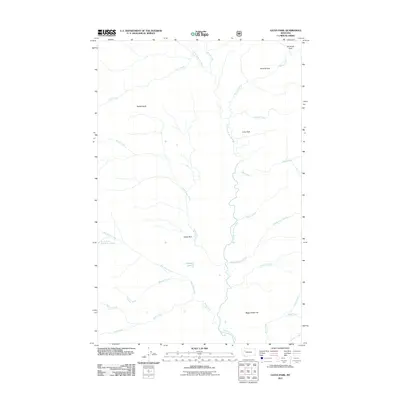
2011 Map of Gates Park
USGS Topo · Published 2011About this map
The North Fork Sun River carves a central path through this backcountry region of Lewis and Clark County, Montana. The landscape is defined by its series of distinct high-meadow openings, including Gates Park, Lone Park, Ninemile Park, and Tenmile Park. These areas provide clear reference points within a complex drainage system fed by numerous named tributaries such as Ray Creek, Spruce Creek, and Headquarters Creek.
Find a feature on this map
25 named features on this map. Tap any name to fly to it.
Don’t see what you’re looking for? This feature index may not catch every label — zoom into the map to look around manually.
Map Details
Editions of this 2011 Gates Park Map
This is the sole edition of this map. No revisions or reprints were ever made.
Other maps of this area

1903 · Saypo
USGS Topo · 1:125,000

1936 · Silvertip
USGS Topo · 1:96,000

1942 · Silvertip
USGS Topo · 1:125,000

1955 · Choteau
USGS Topo · 1:250,000

1957 · Choteau
USGS Topo · 1:250,000

1958 · Choteau
USGS Topo · 1:250,000

1958 · Porphyry Reef
USGS Topo · 1:24,000

1958 · Mount Wright
USGS Topo · 1:24,000

1958 · Our Lake
USGS Topo · 1:24,000

1958 · Glenn Creek
USGS Topo · 1:24,000