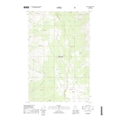
2020 Map of Gates Park
USGS Topo · Published 2020About this map
Lewis & Clark National Forest encompasses this high-altitude landscape where the North Fork Sun River and its numerous tributaries, such as Gates Cr and Rock Cr, carve through the terrain. The central meadow of Gates Park provides a break in the topography between the Sawtooth Range to the east and the Lewis and Clark Range to the west. Evidence of fire observation and mountain navigation is present at Beartop L. O., while the Continental Divide National Scenic Trail winds through the southwestern corner near Goat Ridge. The map details a network of high-country drainage basins including Dryden Cr and Red Shale Cr, illustrating the complex hydrology that feeds the larger river systems of the Montana Rockies. Remote peaks such as Moonlight Peak and prominent landmarks like Rabbit Butte and Wapiti Ridge orient the traveler through this roadless wilderness.
Find a feature on this map
51 named features on this map. Tap any name to fly to it.
Don’t see what you’re looking for? This feature index may not catch every label — zoom into the map to look around manually.
Map Details
Editions of this 2020 Gates Park Map
This is the sole edition of this map. No revisions or reprints were ever made.
Other maps of this area

1903 · Saypo
USGS Topo · 1:125,000

1936 · Silvertip
USGS Topo · 1:96,000

1942 · Silvertip
USGS Topo · 1:125,000

1955 · Choteau
USGS Topo · 1:250,000

1957 · Choteau
USGS Topo · 1:250,000

1958 · Choteau
USGS Topo · 1:250,000

1958 · Porphyry Reef
USGS Topo · 1:24,000

1958 · Mount Wright
USGS Topo · 1:24,000

1958 · Our Lake
USGS Topo · 1:24,000

1958 · Glenn Creek
USGS Topo · 1:24,000