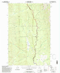
1995 Map of Gates Park
USGS Topo · Published 1997About this map
The Bob Marshall Wilderness and Lewis and Clark National Forest converge in this high-altitude mountain landscape, defined by the winding course of the North Fork Sun River. This 1995 revision documents the remote settlement at Gates Park, where a small cluster of structures and an Landing Strip (Inactive) sit near the shores of Gates Lake. The terrain is marked by significant physical landmarks including the Sawtooth Range to the east and Wapiti Ridge to the north.
Find a feature on this map
39 named features on this map. Tap any name to fly to it.
Don’t see what you’re looking for? This feature index may not catch every label — zoom into the map to look around manually.
Map Details
Editions of this 1995 Gates Park Map
This is the sole edition of this map. No revisions or reprints were ever made.
Other maps of this area

1903 · Saypo
USGS Topo · 1:125,000

1936 · Silvertip
USGS Topo · 1:96,000

1942 · Silvertip
USGS Topo · 1:125,000

1955 · Choteau
USGS Topo · 1:250,000

1957 · Choteau
USGS Topo · 1:250,000

1958 · Choteau
USGS Topo · 1:250,000

1958 · Porphyry Reef
USGS Topo · 1:24,000

1958 · Mount Wright
USGS Topo · 1:24,000

1958 · Our Lake
USGS Topo · 1:24,000

1958 · Glenn Creek
USGS Topo · 1:24,000