
1969 Map of Gauley Bridge
USGS Topo · Published 1973About this map
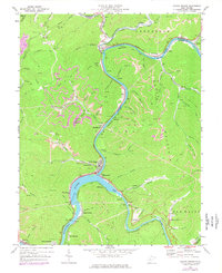
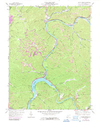
Gauley Mountain dominates the central landscape of this 1969 topographic study, where the Gauley River and New River converge to form the Kanawha River. The river valleys are dense with industrial and transportation infrastructure, featuring the C & O and Penn Central railroads that parallel the winding waterways. Local settlements like Gauley Bridge, Glen Ferris, and Belva are concentrated along these narrow corridors, tucked between steep slopes and the water.
Find a feature on this map
97 named features on this map. Tap any name to fly to it.
Don’t see what you’re looking for? This feature index may not catch every label — zoom into the map to look around manually.
Map Details
Editions of this 1969 Gauley Bridge Map
3 editions found
Other maps of this area

1897 · Kanawha Falls
USGS Topo · 1:125,000

1900 · Kanawha Falls
USGS Topo · 1:125,000

1901 · Kanawha Falls
USGS Topo · 1:125,000

1907 · Clendenin
USGS Topo · 1:62,500

1908 · Clay
USGS Topo · 1:48,000

1908 · Fayetteville
USGS Topo · 1:48,000

1908 · Montgomery
USGS Topo · 1:48,000

1909 · Clendenin
USGS Topo · 1:62,500

1910 · Clay
USGS Topo · 1:62,500

1910 · Fayetteville
USGS Topo · 1:62,500