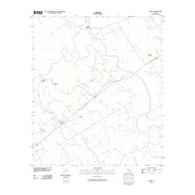
2010 Map of Gause
USGS Topo · Published 2010About this map
The confluence of the Brazos River and Little River defines this river-bottom landscape in Milam and Robertson counties. Near the northern boundary, the settlement of Port Sullivan sits along the Brazos, a site of early river navigation and trade. Further south, the town of Gause serves as a local hub, anchored by its grid of streets and proximity to the rail lines passing through Valley Junction.
Find a feature on this map
34 named features on this map. Tap any name to fly to it.
Don’t see what you’re looking for? This feature index may not catch every label — zoom into the map to look around manually.
Map Details
Editions of this 2010 Gause Map
This is the sole edition of this map. No revisions or reprints were ever made.
Other maps of this area

1954 · Austin
USGS Topo · 1:250,000

1956 · Caldwell
USGS Topo · 1:62,500

1956 · Milano
USGS Topo · 1:62,500

1961 · Mumford
USGS Topo · 1:24,000

1961 · Hanover
USGS Topo · 1:24,000

1961 · Hearne North
USGS Topo · 1:24,000

1961 · Hearne South
USGS Topo · 1:24,000

1962 · Goodwill
USGS Topo · 1:24,000

1962 · Calvert
USGS Topo · 1:24,000

1962 · Maysfield
USGS Topo · 1:24,000