
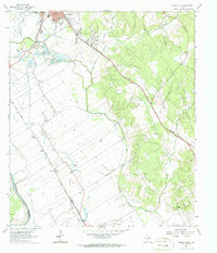
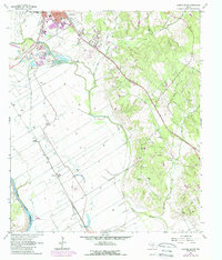
1961 Map of Hearne South
USGS Topo · Published 1964About this map
Hearne serves as the central hub of this Robertson County landscape, where the Missouri Pacific and Southern Pacific railroads converge to define the town's industrial layout. The surrounding terrain is a mix of agricultural lowlands along the Little Brazos River and wooded elevations to the east. The map captures a detailed inventory of community life in the early 1960s, documenting local landmarks like Blackshear High Sch, General Hospital, and several rural sanctuaries including Lee Chapel and Wilson Chapel. To the south, smaller railway-side settlements such as Nicholas and Mumford appear alongside extensive oil and gas Pipeline infrastructure. The transition from the alluvial plain to the higher ground near Five Point Ch illustrates the geographic diversity of this Brazos Valley region during a period of steady mid-century development.
Find a feature on this map
29 named features on this map. Tap any name to fly to it.
Don’t see what you’re looking for? This feature index may not catch every label — zoom into the map to look around manually.
Map Details
Editions of this 1961 Hearne South Map
3 editions found
Other maps of this area

1954 · Austin
USGS Topo · 1:250,000

1956 · Bryan
USGS Topo · 1:62,500

1956 · Caldwell
USGS Topo · 1:62,500

1961 · Mumford
USGS Topo · 1:24,000

1961 · Hearne North
USGS Topo · 1:24,000

1962 · Goodwill
USGS Topo · 1:24,000

1962 · Calvert
USGS Topo · 1:24,000

1962 · Wheelock
USGS Topo · 1:24,000
1962 · Gause
USGS Topo · 1:24,000
1962 · Bryan West
USGS Topo · 1:24,000