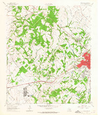
1962 Map of Bryan West
USGS Topo · Published 1965About this map
The Little Brazos River winds through this Central Texas landscape, defining a rural-to-urban transition as the western edge of Bryan begins to expand. In the early 1960s, this area remained largely defined by its rail connections and educational institutions, most notably the Texas A & M University Research Annex situated in the southwestern corner. Two major rail lines, the Southern Pacific and Missouri Pacific, cut across the terrain, serving small communities like Smetana and Benchley on the Robertson and Brazos county line. The map reveals a deeply rooted local history through its numerous family and community landmarks, including the Rest-Ever Memorial Cem, Henry Cem, and Santa Teresa Ch. From the wooded banks of Thompsons Creek to the Gravel Pits along Old Hearne Road, the sheet documents a working landscape of agriculture and early suburban growth.
Find a feature on this map
38 named features on this map. Tap any name to fly to it.
Don’t see what you’re looking for? This feature index may not catch every label — zoom into the map to look around manually.
Map Details
Editions of this 1962 Bryan West Map
4 editions found
Other maps of this area

1954 · Austin
USGS Topo · 1:250,000

1956 · Bryan
USGS Topo · 1:62,500

1956 · Caldwell
USGS Topo · 1:62,500

1961 · Mumford
USGS Topo · 1:24,000

1961 · Hearne South
USGS Topo · 1:24,000

1961 · Wellborn
USGS Topo · 1:24,000
1962 · Tunis
USGS Topo · 1:24,000
1962 · Chances Store
USGS Topo · 1:24,000

1962 · Bryan East
USGS Topo · 1:24,000
1963 · Dunn Creek
USGS Topo · 1:24,000