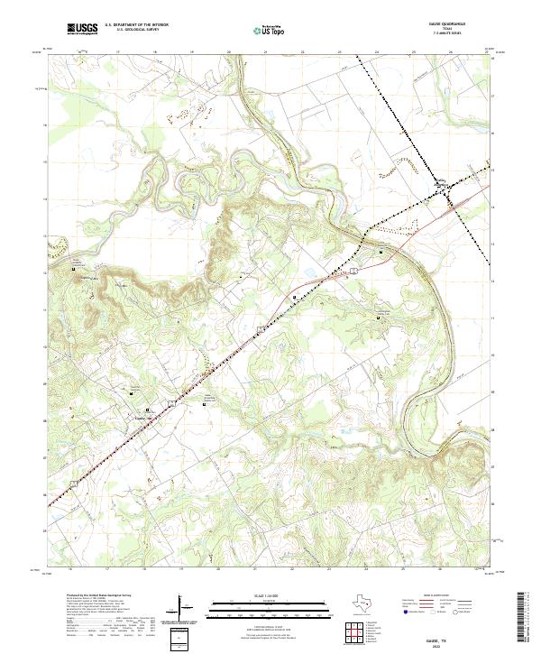
2022 Map of Gause
USGS Topo · Published 2022About this map
The confluence of the Little River and the Brazos River dominates this portion of the Texas landscape, marking the border between Milam and Robertson counties. The settlement of Valley Junction sits at a critical rail intersection in the northeast, while the town of Gause serves as the local hub to the southwest. This area is notably dense with small family and community burial grounds, providing a significant record of early local genealogy. Notable sites include the Old Nashville Cem near the riverbanks and the Black Israelite Church Cem situated near the foot of Sugarloaf Mtn. The terrain transitions from the broad alluvial plains of Dollar Cr and Threemile Cr to prominent elevations like Long Mtn, reflecting the varied geography of the Brazos Valley.
Find a feature on this map
51 named features on this map. Tap any name to fly to it.
Don’t see what you’re looking for? This feature index may not catch every label — zoom into the map to look around manually.
Map Details
Editions of this 2022 Gause Map
This is the sole edition of this map. No revisions or reprints were ever made.
Other maps of this area

1954 · Austin
USGS Topo · 1:250,000

1956 · Caldwell
USGS Topo · 1:62,500

1956 · Milano
USGS Topo · 1:62,500

1961 · Mumford
USGS Topo · 1:24,000

1961 · Hanover
USGS Topo · 1:24,000

1961 · Hearne North
USGS Topo · 1:24,000

1961 · Hearne South
USGS Topo · 1:24,000

1962 · Goodwill
USGS Topo · 1:24,000

1962 · Calvert
USGS Topo · 1:24,000

1962 · Maysfield
USGS Topo · 1:24,000