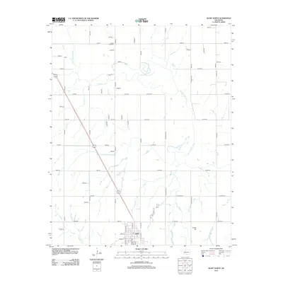
2012 Map of Geary North
USGS Topo · Published 2012About this map
Geary anchors the southern edge of this Oklahoma landscape, situated at the intersection of several regional routes as they move north across the North Canadian River. The river winds through the terrain in a series of dramatic oxbows and meanders, flanked by a network of drainage features like Horse Cr and Lumpmouth Cr. This 2012 survey illustrates the structured agricultural grid characteristic of the region, defined by an extensive system of section-line roads such as n2600 RD and e0950 RD.
Find a feature on this map
59 named features on this map. Tap any name to fly to it.
Don’t see what you’re looking for? This feature index may not catch every label — zoom into the map to look around manually.
Map Details
Editions of this 2012 Geary North Map
This is the sole edition of this map. No revisions or reprints were ever made.
Other maps of this area

1893 · Fort Reno
USGS Topo · 1:62,500

1893 · Loyal
USGS Topo · 1:62,500

1941 · Fort Reno
USGS Topo · 1:62,500

1942 · Fort Reno
USGS Topo · 1:62,500

1942 · Geary
USGS Topo · 1:62,500

1949 · Fort Reno
USGS Topo · 1:62,500

1955 · Clinton
USGS Topo · 1:250,000

1957 · Clinton
USGS Topo · 1:250,000

1967 · Fort Reno SW
USGS Topo · 1:24,000

1972 · Watonga
USGS Topo · 1:24,000