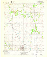
1979 Map of Geary North
USGS Topo · Published 1979About this map
Geary serves as the primary hub at the southern edge of this West-Central Oklahoma landscape, where the Chicago Rock Island and Pacific railroad forms a diagonal line through the plains. The terrain is defined by the winding course of the North Canadian River, which creates a complex border between Blaine and Canadian counties. Natural landmarks like Left Hand Spring and Coyote Hill offer reference points for the local topography.
Find a feature on this map
20 named features on this map. Tap any name to fly to it.
Don’t see what you’re looking for? This feature index may not catch every label — zoom into the map to look around manually.
Map Details
Editions of this 1979 Geary North Map
This is the sole edition of this map. No revisions or reprints were ever made.
Other maps of this area

1893 · Fort Reno
USGS Topo · 1:62,500

1893 · Loyal
USGS Topo · 1:62,500

1941 · Fort Reno
USGS Topo · 1:62,500

1942 · Fort Reno
USGS Topo · 1:62,500

1942 · Geary
USGS Topo · 1:62,500

1949 · Fort Reno
USGS Topo · 1:62,500

1955 · Clinton
USGS Topo · 1:250,000

1957 · Clinton
USGS Topo · 1:250,000

1967 · Fort Reno SW
USGS Topo · 1:24,000

1972 · Watonga
USGS Topo · 1:24,000